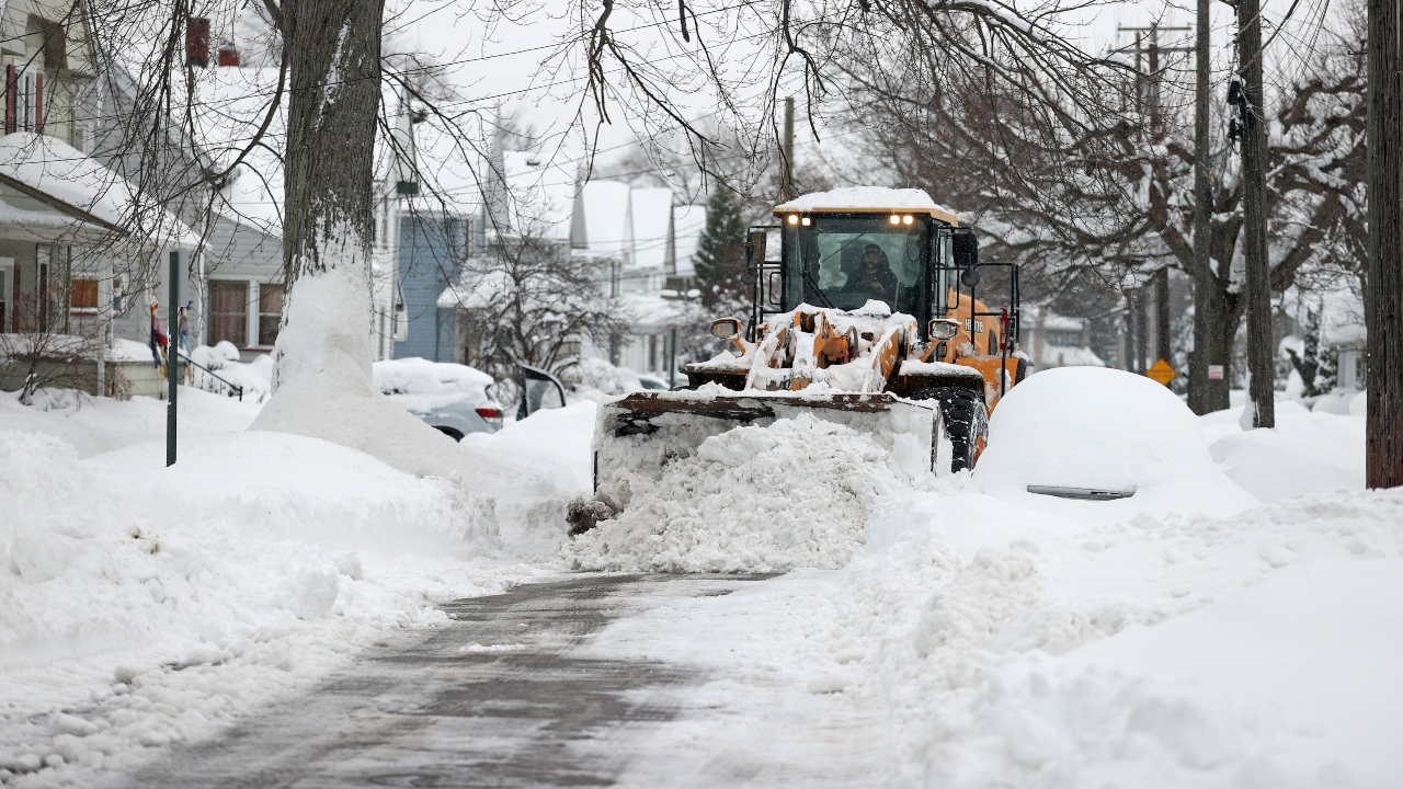
Cleveland Area Lake-Effect Snow Warning: Up to 13 Inches and Strong Winds Through Friday
Residents across the Cleveland region are bracing for hazardous winter weather as a powerful lake-effect snow event continues to intensify. Local authorities have issued a Lake-Effect Snow Warning through Friday, cautioning that snowfall totals could reach up to 13 inches in some areas, accompanied by wind gusts of nearly 50 mph.
Heavy Snow Bands Expected to Shift
Forecasters report that narrow but intense snow bands are developing over Lake Erie and drifting inland throughout Cuyahoga, Lake, Geauga, and Ashtabula counties. These bands are expected to shift repeatedly, creating sudden drops in visibility and rapid snow accumulation within minutes.
Travel conditions may deteriorate quickly, especially during the overnight hours when snowfall is expected to peak. Drivers are urged to avoid unnecessary travel and prepare for slippery roads, blowing snow, and possible whiteout conditions.
Strong Winds to Increase Hazards
Wind gusts reaching 45–50 mph will contribute to blowing and drifting snow, making road clearing more difficult for crews. The combination of heavy snow and strong winds could also lead to scattered power outages, especially in open or elevated areas.
Residents living near the Lake Erie shoreline may experience the most intense conditions. Snowfall rates could exceed 1 inch per hour during the strongest periods.
Cold Temperatures to Persist
Temperatures will remain below freezing throughout the week, preventing any significant melting. Wind chills are expected to drop into the teens, adding an extra layer of discomfort and increasing the risk of frostbite for anyone outdoors for extended periods.
Officials Urge Preparedness
Emergency officials are advising residents to:
-
Keep extra blankets, food, and water on hand
-
Charge mobile devices in advance
-
Check vehicles for winter-readiness
-
Allow extra travel time or delay travel if possible
-
Stay updated with local weather alerts
As crews work around the clock to keep main roads clear, authorities emphasize that conditions may vary widely over short distances due to the nature of lake-effect snow.
What’s Next?
The heaviest snowfall is expected to persist through Friday morning before tapering off later in the day. However, lingering flurries and gusty winds may continue to impact visibility and travel even after the main snow bands weaken.
Residents are encouraged to stay alert and exercise caution until the weather system fully moves out of the region.

Pulkeet Gupta is a dedicated content writer specializing in the field of education and entertainment niche. With a passion for learning and a keen interest in sharing knowledge, Pulkeet has established himself as a prominent figure in the education and entertainment writing community.